Map viewer
Map viewer shows geospatial data on a map as either markers, or a heat map.
Adding
- Go to Tables and expand the Viewers panel.
- Locate the Map Viewer icon and click it.
Developers: To add the viewer from the console, use:
grok.shell.tv.addViewer('Map');
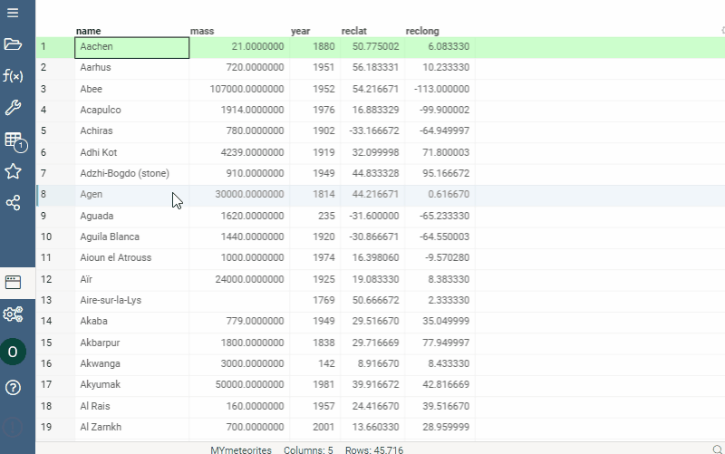
When you add a map viewer, it tries to automatically detect columns that contain longitude and latitude values.
Settings
To configure a map, click the Gear icon on top of the viewer and use the info panels on the Context Pane. For example, you can:
- Color-code points using the
Colorproperty - Size-code points using the
Sizeproperty - Control point size by using
Marker Min SizeandMarker Max Sizeproperties
Interactivity
- Shows only filtered rows
- Shows selected rows in orange
- Synchronizes current record upon clicking on the point
Custom file viewers
Custom file viewers let you view files of various geographic extensions. To see one, open the file manager, hover your mouse over the file, and click on it, as shown below.
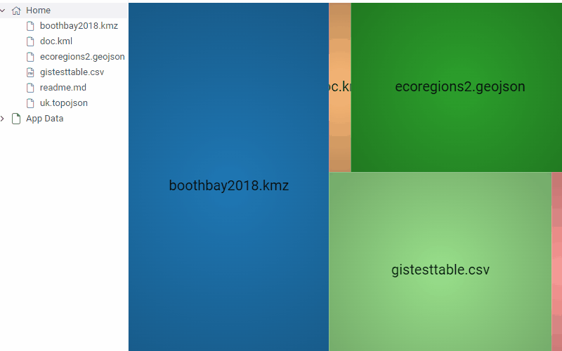
The system provides interaction with files of the following extensions:
- .geojson
- .topojson
- .kmz
- .kml
Controls
| Action | Control |
|---|---|
| Zoom in | Mouse Wheel Up or Plus |
| Zoom out | Mouse Wheel Down or Minus |
| Add a point to selection | Shift+Click the point |
| Select multiple points | Ctrl+Mouse Drag |
See also
Properties
| Property | Type | Description |
|---|---|---|
| General | ||
| Region Column Name | string | |
| Color Column Name | string | |
| Color Aggr Type | string | |
| Show Color Scale | boolean | |
| Show Color Selector | boolean | |
| Allow Pan Zoom | boolean | |
| Linear Color Scheme | list | |
| Categorical Color Scheme | list | Applies only to columns with 100+ categories; below that, the column''s color coding is used. |
| Row Source | string | Determines the rows shown on the plot. |
| Allow Dynamic Menus | boolean | |
| Show Context Menu | boolean | Properties common for all viewers todo: use code generation |
| Title | string | |
| Description | string | Viewer description that gets shown at the Descriptor Position. Markup is supported. |
| Help | string | Help to be shown when user clicks on the ''?'' icon on top. Could either be in markdown, or a URL (starting with ''/'' or ''http''). |
| Description Position | flexposition | |
| Description Visibility Mode | visibilitymode | |
| Data | ||
| Filter | string | Formula that filters out rows to show. Examples: ${AGE} > 20 or ${WEIGHT / 2)} > 100, ${SEVERITY} == ''Medium'', ${RACE}.endsWith(''sian'') |
| Table | string | |
| Style | ||
| Controls Font | string | Viewer controls elements font. |
| Description | ||
| Show Title | boolean |